Consumer Drone Mapping
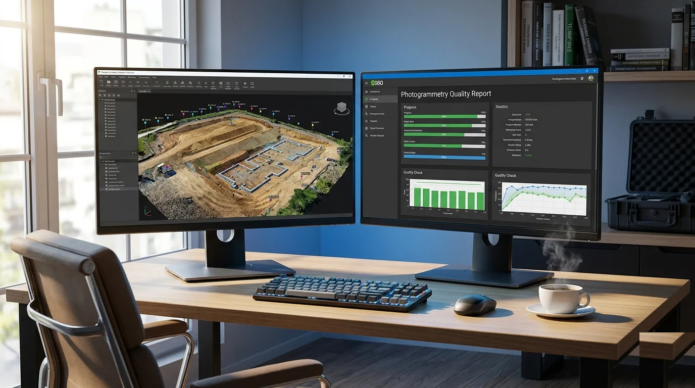
WebODM vs Pix4D for Consumer Drone Data: Free vs Paid Processing Paths
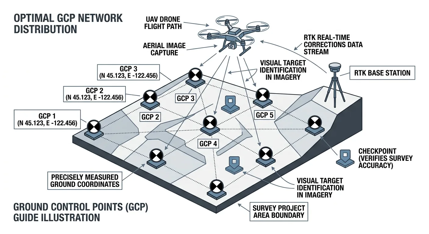
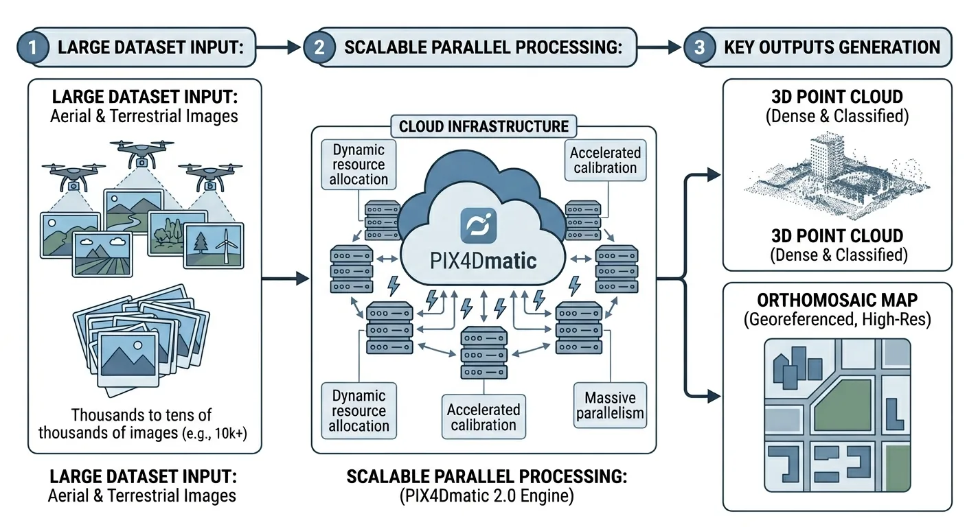
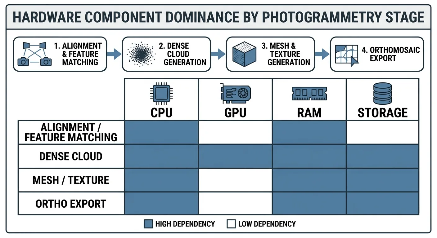
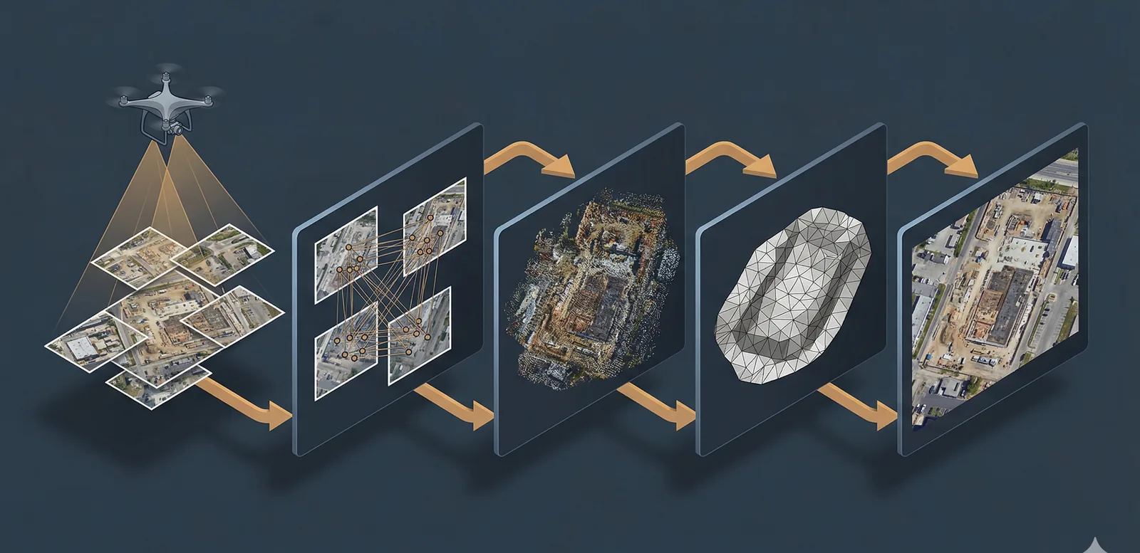
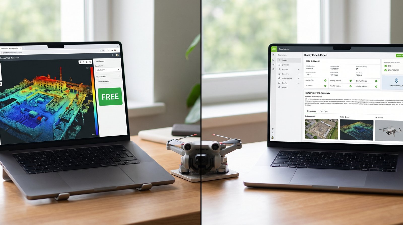
WebODM (free) vs Pix4D (paid) for consumer drone imagery: orthomosaic quality, processing time, accuracy, GCP workflow, cost analysis, when to use each.
Read more →